
The History of Little River Turnpike
By Michael McDonnell
Written for the ENDEAVOR News Magazine
 Did you ever wonder why a road through the heart of Annandale is named for a river nearly 30 miles west in Aldie, Virginia? A wonderful aspect of this story illustrates how some situations several hundred years ago have remained the same or have exact parallels today!
Three major wagon roads were evolving for agricultural trade and migration in the mid-eighteenth century in northern Virginia: the Potomac Path, (today part of Rt. 1 to Fredericksburg); the nascent Leesburg Pike, (now Route 7 from Alexandria to Leesburg); and the Philadelphia Wagon Road, tying German-speaking western Pennsylvania and Maryland families migrating into the fertile Shenandoah Valley, (now seen as routes 11 and 81).
In 1772, Virginians in our area petitioned the House of Burgesses for funds for a Fredericksburg Road. The House rejected the proposal and recommended that local counties take over responsibility. Does this battle sound familiar? But something was changing in Virginia. By 1775, of the twenty listed mercantile firms in Alexandria – the wealthy regional trade center and river port – only three were exclusively dealing with tobacco. This agricultural shift meant changes in the Virginia landscape as well. Plantations needed rivers for tobacco. However, “inner” plantations – soon-to-be-smaller farms – had discovered that tobacco was very hard on the soil, and they began the switch to wheat and other grains, which required roads to mills and central shipping areas, rather than to the larger plantations’ river routes.
Responsibility for the roads had returned to the Commonwealth by 1785 but, at a loss for funding, Virginia authorized private companies to set up toll gates with tolls to pay for road improvement, eerily matching today’s beltway Express (H.O.T.) lanes and the Greenway projects! This change is recorded in newspapers in cities as distant as Baltimore, where a 1793 newspaper advertised a mill for sale, located a mile from Alexandria and “within call of the Turnpike Road down which all the wheat, from extensive and fertile country, intended for the Alexandria Market, is conveyed.” By 1795, the first commission was granted to a group to actually rebuild roads with privately raised capital. That was the Fairfax and Loudoun Turnpike Road Company, which set about building what is today Route 236.
Stock sales for this new company took place from Alexandria to Blue Ridge; some stock advertisements were printed in German for the Shenandoah Valley residents. Not surprisingly, most if not all the commissioners owned homes and/or land all along the route into the mountains. Although this company ended up in failure, they reorganized to become the Little River Turnpike Company in 1801, so great was the desire to have passable transportation from the western farms into Alexandria. Investing partners included Richard Bland Lee, Northern Virginia’s first congressman and builder of Sully, located adjacent to the planned route in Chantilly and which you can visit today.
Most of the property issues involved in building the road were resolved through eminent domain laws, and Virginia confiscated building material from forests, farms, and quarries along the entire route. The turnpike laws required roads to be 60 feet across, and also required an 18 foot-wide swath be covered with gravel or stone. Only then could the company set up toll houses and gates. Parallel to today’s arguments over Metro and funding, there were some tricky border issues to work out, since Alexandria was not in Virginia but part of District of Columbia. However, in 1804 Virginia had to purchase most of the stock to keep the company from foundering! Therefore, it was privately run but still government subsidized. Still seems familiar, doesn’t it?
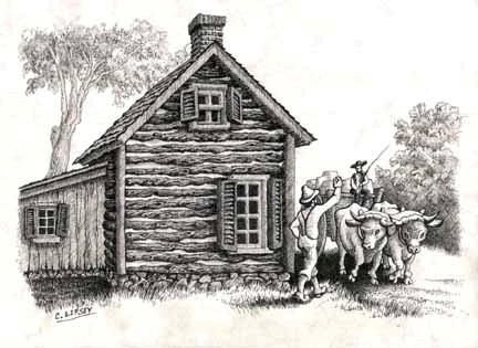
By 1806 the Little River Turnpike extended 10 miles, with 2 toll gates, and had collected $787 in tolls. It ran from Alexandria, past John Moss’ Green Spring Farm (today’s Green Spring Gardens), through Annandale and into the town of Providence, later named Fairfax. In 1812 the company recorded 35 miles of road, 7 gates and, by 1818, $30,000 in tolls, quite a profitable sum. An 1826 letter refers to Aldie, where a flour mill had been built on the Little River, and where the road forked into the Snickers Gap Pike to Berryville. The letter notes the turnpike as a “busy road full of wagons morning and night.” Some folks counted at least a hundred per day. Another letter refers to the “Roughest pavement I was ever on… paved all the way to Alexandria…not a bad policy to have one’s life and limbs insured before undertaking the trip.”
Now remember these weren’t the asphalt ribbons we see today! By 1827, letters display a hue and cry to use the “M’Adam plan” on the road, referencing Scotsman John Loudon McAdam’s method of using smaller stone crushed into larger stone atop a leveled but natural landscape surface. This method digressed from earlier road construction which required much large “boulder” rock as the first layer. Wide-wheeled wagons paid no tolls on “macadamized” roads, since the wider iron wheels helped to pack the road down. Today’s asphalted roads, trails and runways are often actually an engineered stone surface that has been bound with tar spray – thus the origin of “tarmac”.
Alexandria’s wealth started declining by the 1820’s. Many merchants were dealing with Philadelphia directly for overseas shipping and transport. However, the Little River Turnpike still was in use, and soon there rose a new American middle class, with expendable wealth, nascent “vacations” to western “baths”, and scenic trips to de rigor destinations such as Thomas Jefferson’s Natural Bridge. Road traffic for Greenbrier, Monroe, Bath, and Alleghany Counties all picked up in the Commonwealth, and 1835 records note nearly 15,000 annual tourists used the turnpikes, canals, railroads, and stage connections.
However the rollercoaster of economic dependence took its toll on tolls, and by the mid-19th century unstable dollars, farm depressions, high maintenance, and of course the American Civil War prompted citizens to avoid the now poorly-kept “shunpikes”, and by 1896 Virginia had to take complete possession of most the turnpikes.

(Copyright © 2012 Annandale Chamber of Commerce. All rights reserved. (Photographs & images, on this page, and on this website, are not available for use by other publications, blogs, individuals, websites, or social media sites.)
Copyright 2012 Annandale Chamber of Commerce. All rights reserved. Privacy Policy
